
Municipal Infrastructure GIS Workflow
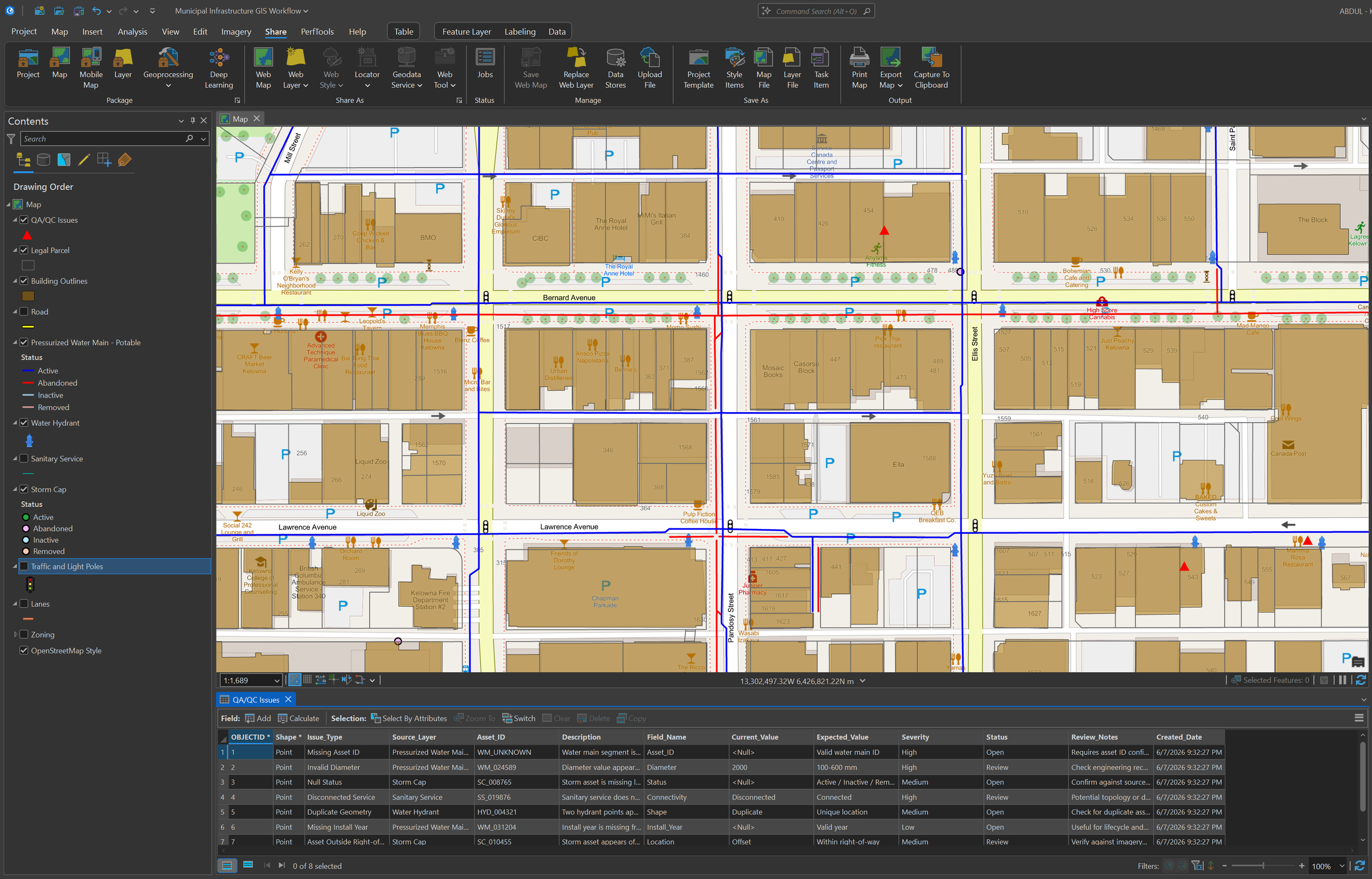
A representative ArcGIS Pro workflow showing how municipal infrastructure layers can be organized, reviewed, and prepared for QA/QC, mapping, and project communication.
Tools Used


ArcGIS Pro
Python



SQL
Geodatabases
Open Data
-
Municipal GIS environments often bring together roads, parcels, buildings, utilities, drainage assets, and operational information maintained by different departments or systems. Before these datasets can support planning or asset review, they need to be organized, checked, and presented in a way that makes potential data issues easy to identify.
I developed this representative ArcGIS Pro workflow using public/open data and simulated QA/QC issue records. The objective was to demonstrate how municipal infrastructure information can be structured for map review, attribute validation, issue tracking, and project communication.
-
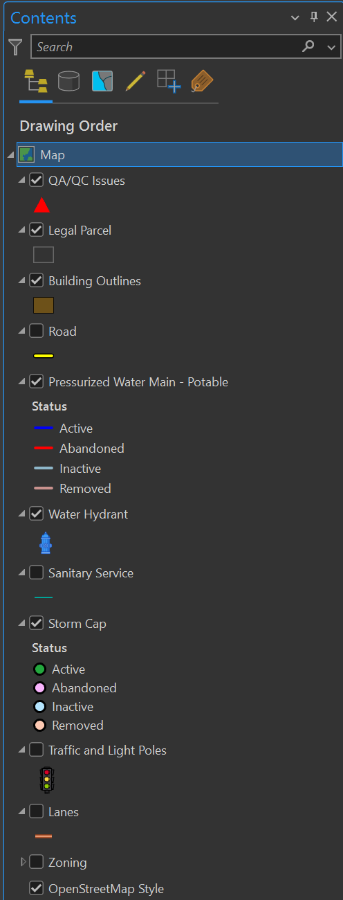
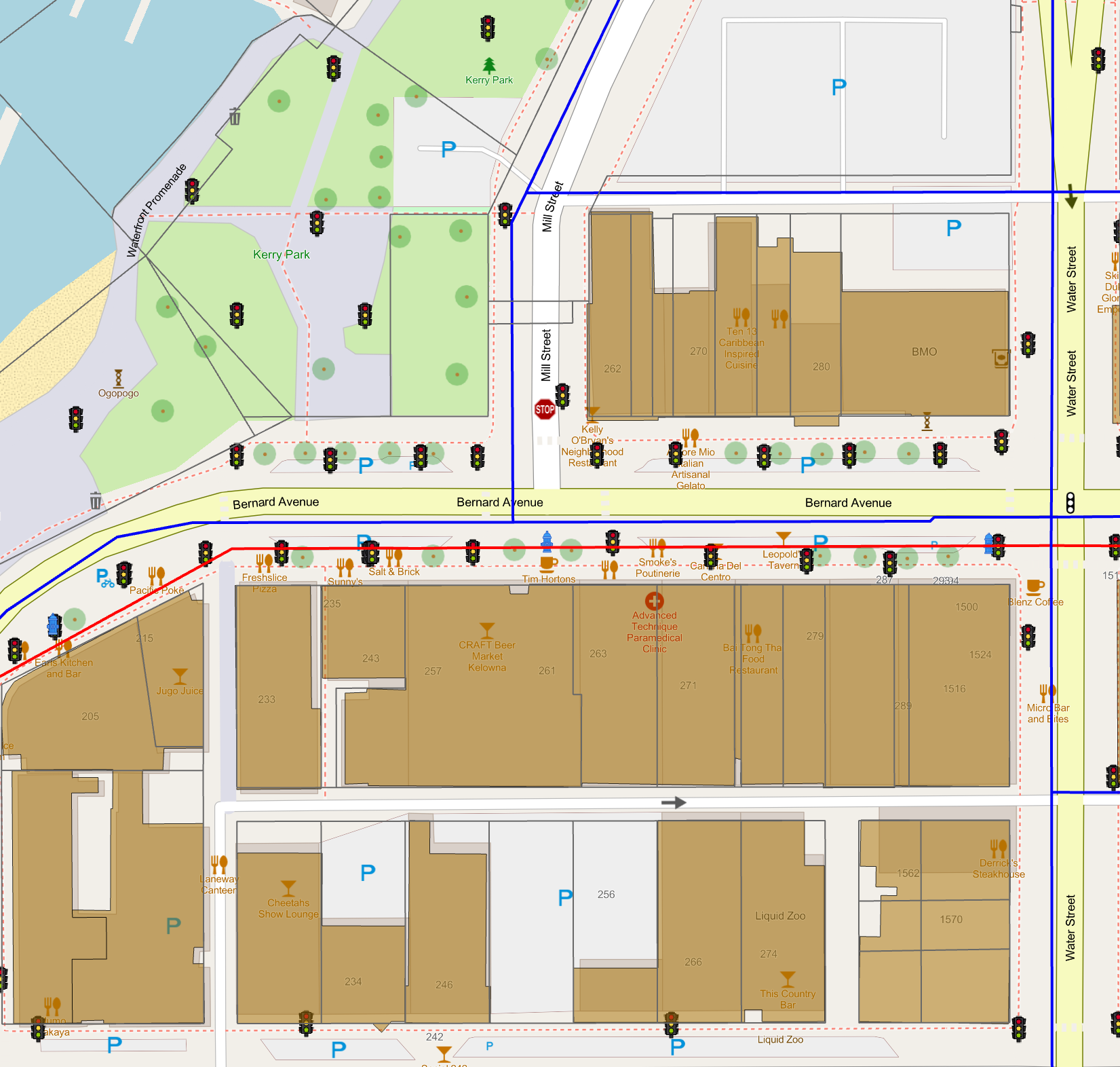
Infrastructure datasets were added to a structured ArcGIS Pro project and organized into logical groups, including:
Roads and transportation
Parcels and buildings
Water mains and hydrants
Sanitary services
Stormwater and drainage assets
Supporting reference and basemap information
Layer names, visibility ranges, drawing order, and symbology were standardized so related infrastructure systems could be reviewed together without overwhelming the map.
The project structure was designed to make it easy for another GIS user or project-team member to understand where each dataset belongs and how it contributes to the overall review.
-
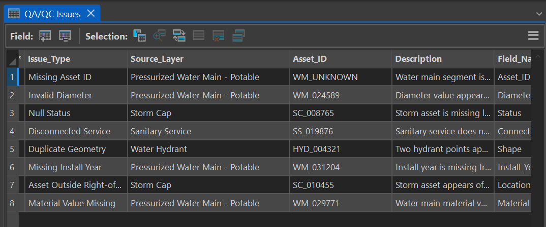
A dedicated QA/QC point layer was created to document potential data issues found during review.
The issue layer includes fields for:
Issue identifier
Source dataset
Asset identifier
Issue type
Severity
Review status
Assigned reviewer
Notes and recommended action
Controlled values support consistent classification and allow issues to be filtered by severity, status, source layer, or reviewer.
Representative issues include missing attributes, positional concerns, disconnected infrastructure, duplicate features, inconsistent classifications, and records requiring further confirmation.
This approach keeps the original infrastructure data separate from the review record while creating a clear audit trail of items requiring attention.
-
Symbology was configured so infrastructure systems remain distinguishable while QA/QC issues are visually prominent.
The map, layer structure, and attribute tables support several review tasks:
Locating issues in their spatial context
Comparing issues against the affected infrastructure layer
Filtering records by severity or status
Reviewing notes and recommended actions
Tracking whether issues are open, under review, or resolved
Communicating findings to project teams and non-GIS stakeholders
The resulting workspace can support internal GIS review, consultant-submission checks, infrastructure-data cleanup, or preparation for web-based review.
-
The completed workflow provides:
An organized municipal infrastructure map workspace
Standardized infrastructure layer presentation
A structured QA/QC issue register
Severity and review-status classifications
Attribute-based issue tracking
Review-ready map and table outputs
A repeatable approach to infrastructure-data validation
The project demonstrates how ArcGIS Pro can be used not only to display municipal assets, but also to organize the review process, document findings, and support clear follow-up.

This is a representative portfolio workflow created using public/open datasets and mock QA/QC issue points. It is not an official municipal product.