
Habitat Suitability & Connectivity Modelling
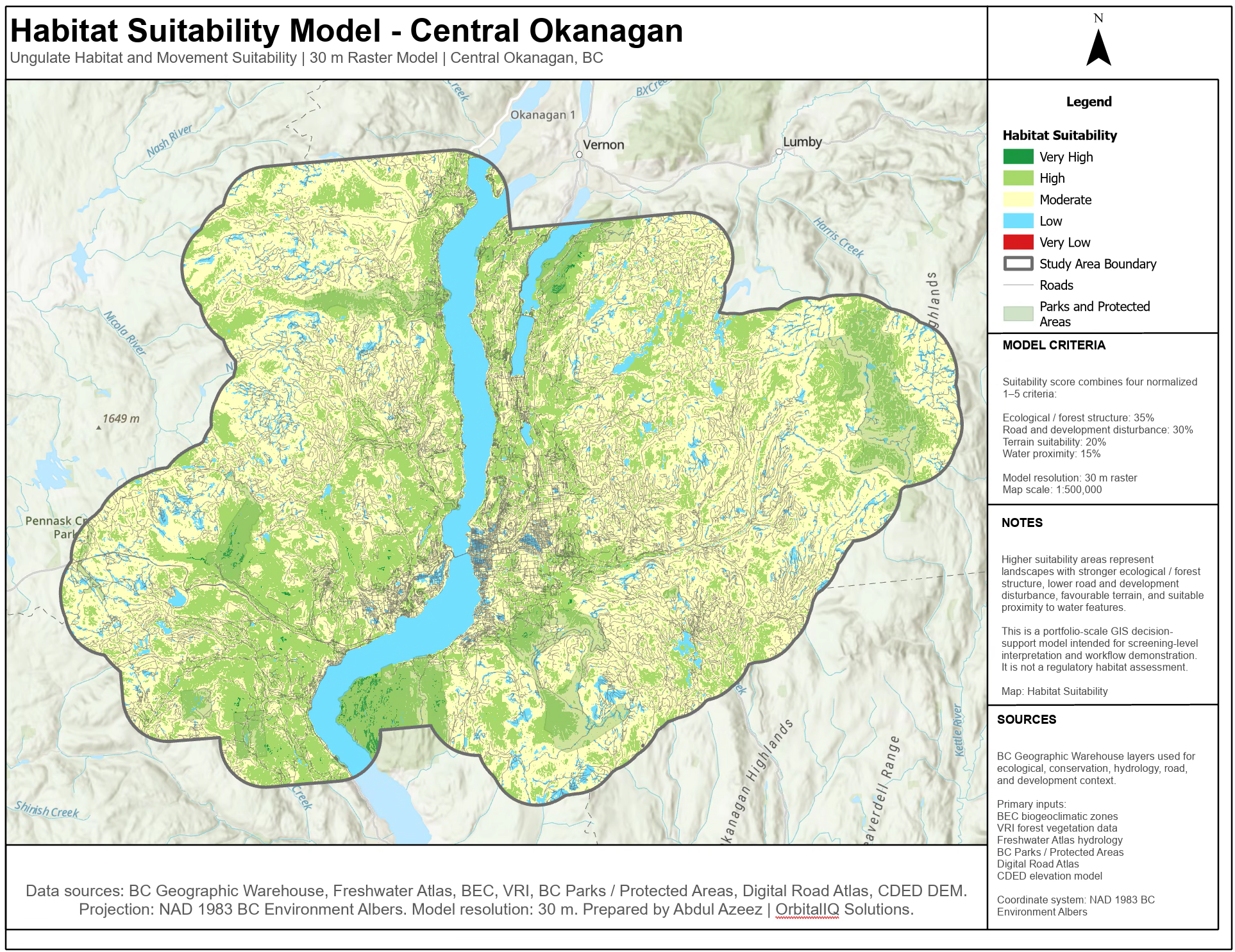
This project demonstrates a GIS-based habitat suitability modelling workflow for ungulate movement and habitat screening in the Central Okanagan. The analysis combines ecological, terrain, hydrology, road, development, and conservation datasets into a weighted 30 m raster suitability model.
The final output identifies areas of very low to very high habitat suitability across the study area and presents the results in a clean map layout suitable for environmental planning, conservation screening, and geospatial decision support.
This is a portfolio-scale modelling project designed to demonstrate workflow design, raster scoring, data integration, and cartographic presentation. It is not intended to replace field-based ecological assessment or regulatory habitat review.

Tools Used

Feature Layers
Geodatabase



ArcGIS Pro
Python
LiDAR
-
The project began by preparing a Central Okanagan study area and clipping all source datasets to a consistent modelling extent. This ensured that terrain, forest, hydrology, road, development, and conservation inputs were spatially aligned before scoring and modelling.
-
A 30 m DEM was used to derive slope, aspect, elevation, and hillshade products. Terrain suitability was scored based on landscape conditions relevant to ungulate movement and habitat use, including favourable slope ranges, elevation bands, and aspect exposure.
-
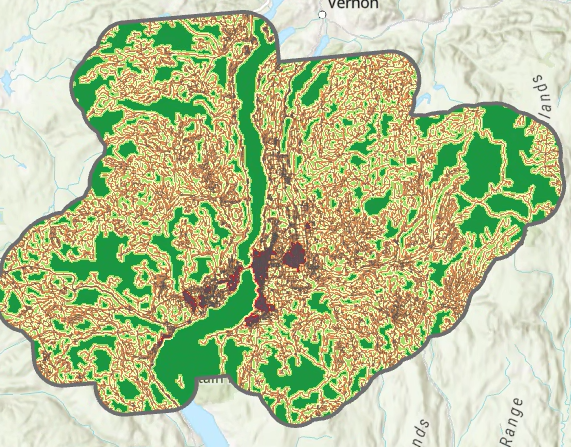
Roads and built-up areas were used to create disturbance-distance scores. Areas closer to roads and development were assigned lower suitability values, while areas farther from disturbance were assigned higher values. This helped represent the effect of human access and landscape fragmentation.
-
Streams, lakes, rivers, wetlands, and manmade waterbodies were used to model water proximity. The scoring logic favored areas near, but not directly within, water features. Open water was treated separately to avoid misrepresenting lakes and rivers as terrestrial habitat.
-
BEC and VRI datasets were used to represent broad ecological context and forest vegetation structure. These inputs helped identify areas with stronger modelled habitat value based on forest cover, ecological setting, and vegetation characteristics.
-
The final model combined ecological / forest structure, disturbance, terrain, and water proximity into a weighted 30 m raster suitability surface. The output was classified into five suitability classes ranging from Very Low to Very High and prepared as a decision-support map.
-
The final map layout was designed to communicate the model clearly, with a simplified legend, model criteria, interpretation notes, data sources, projection information, and a portfolio-scale limitation statement. The layout is intended to show both technical GIS modelling and professional map communication.
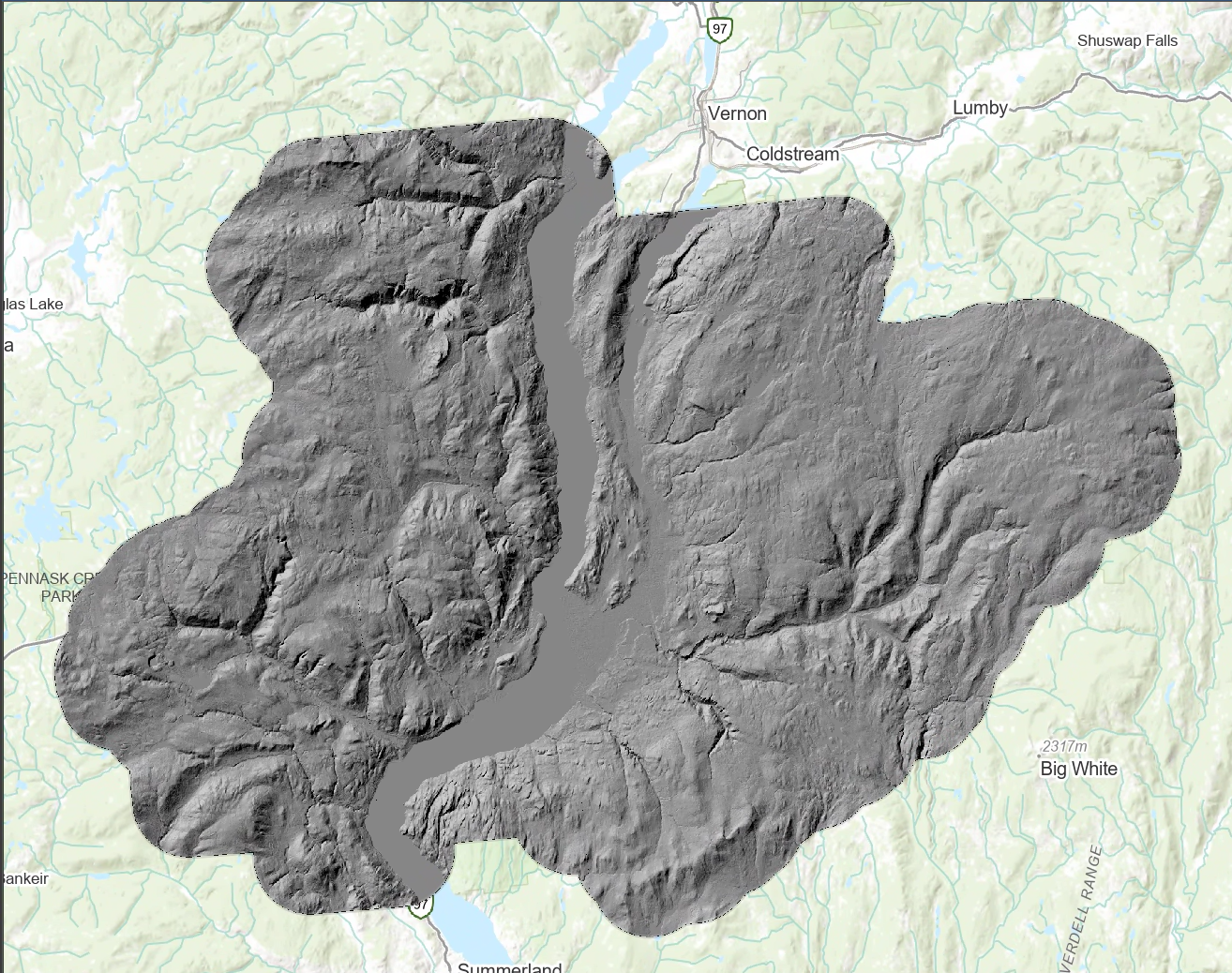
Processed 30 m elevation model and hillshade surface used as the terrain foundation for deriving slope, aspect, elevation, and landscape suitability criteria.
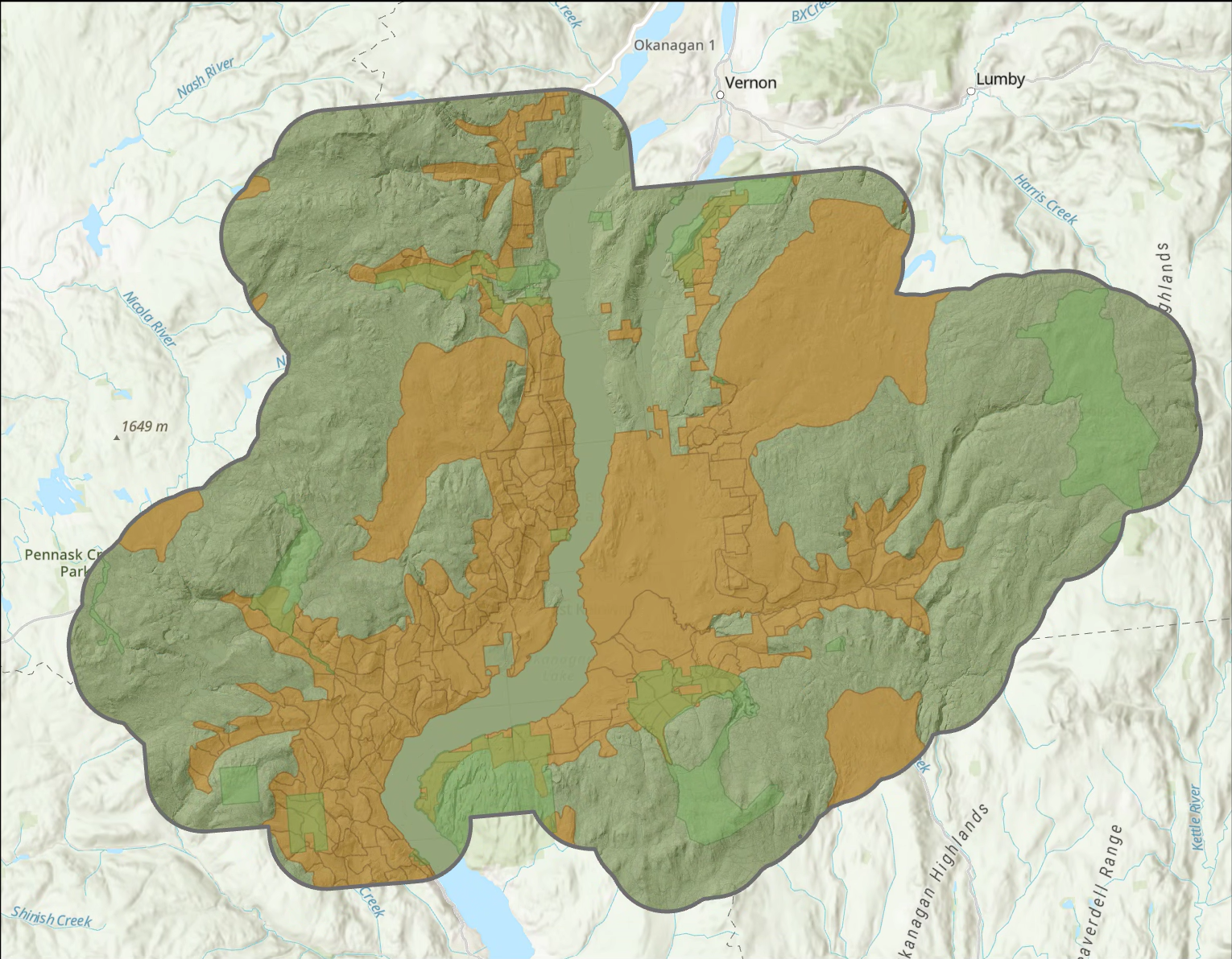
Compiled ecological, forest, conservation, and wildlife habitat datasets clipped to the study area to create a consistent input package for suitability modelling.
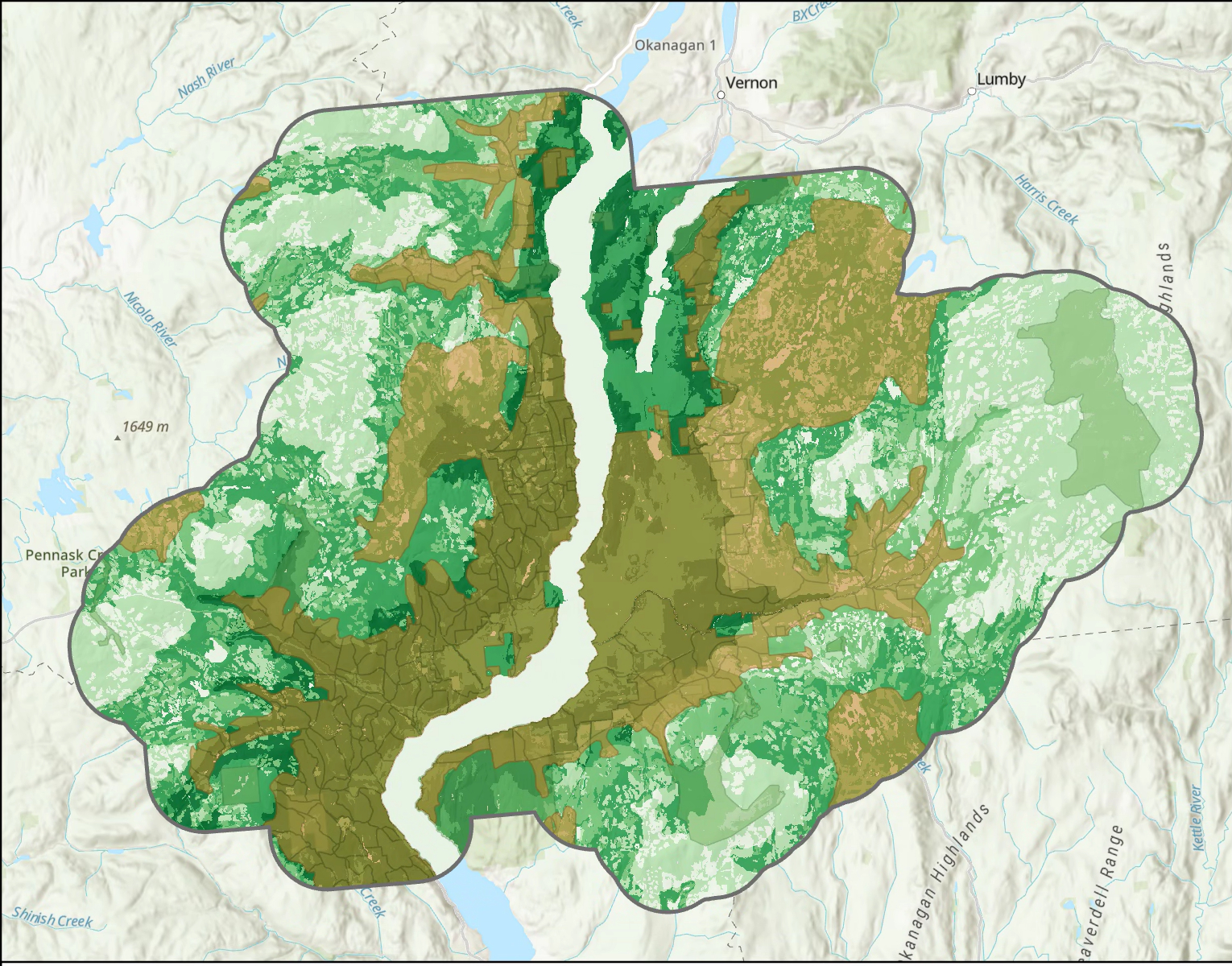
Ecological and forest-structure suitability score combining BEC and VRI inputs to represent broad habitat-supporting landscape conditions across the study area.
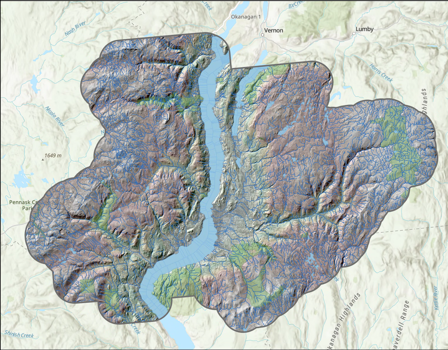
Road and development disturbance score showing reduced suitability near transportation corridors and built-up areas, with higher suitability assigned farther from human disturbance.

This representative portfolio workflow was developed using public/open geospatial datasets to demonstrate habitat suitability modelling, raster scoring, environmental data integration, and decision-support mapping. It is not an official wildlife assessment, regulatory habitat review, or operational planning product.