
Stream Crossing Field Inspection & Mobile Data Workflow
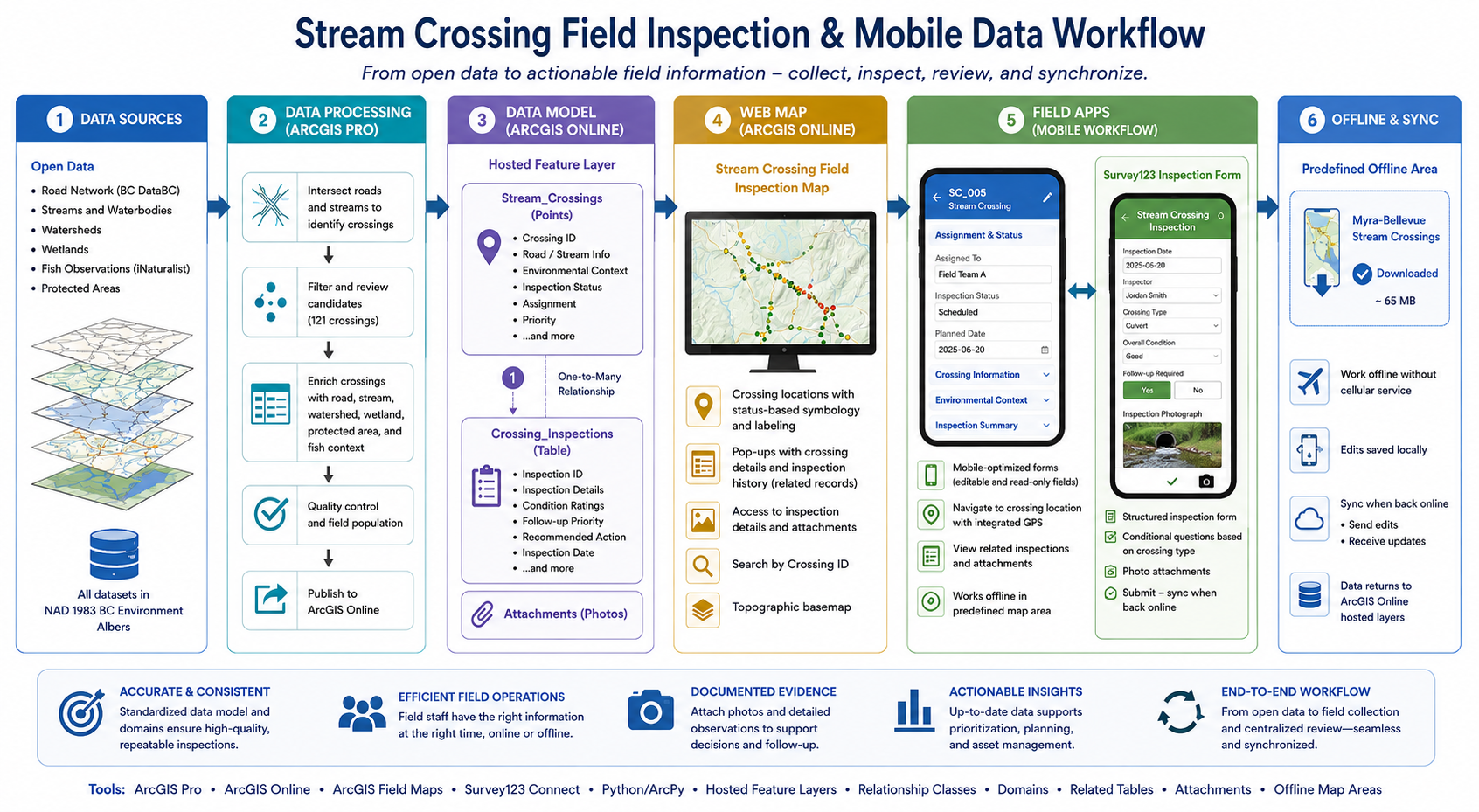
An end-to-end mobile GIS workflow for managing 121 stream-crossing locations, related inspections, environmental context, field photographs, offline Field Maps access, and structured Survey123 inspection forms.

Tools Used

ArcGIS Online
ArcGIS Field Maps



ArcGIS Pro
Python
Survey123 Connect
-
Field teams need more than a map showing where stream crossings are located. They need a reliable way to find assigned sites, review surrounding road and environmental context, complete inspections consistently, attach photographs, and continue working where cellular service may be limited.
I developed this representative workflow using public/open datasets and simulated inspection records. The objective was to demonstrate how ArcGIS Pro, ArcGIS Online, and ArcGIS Field Maps can support an end-to-end field inspection process—from preparing crossing locations and environmental context to mobile review, related inspection history, attachments, offline access, and synchronization.
The project focuses on practical field operations rather than a standalone map. Crossing locations act as permanent parent records, while individual inspections are stored separately so each crossing can retain a complete history of repeat visits.
-
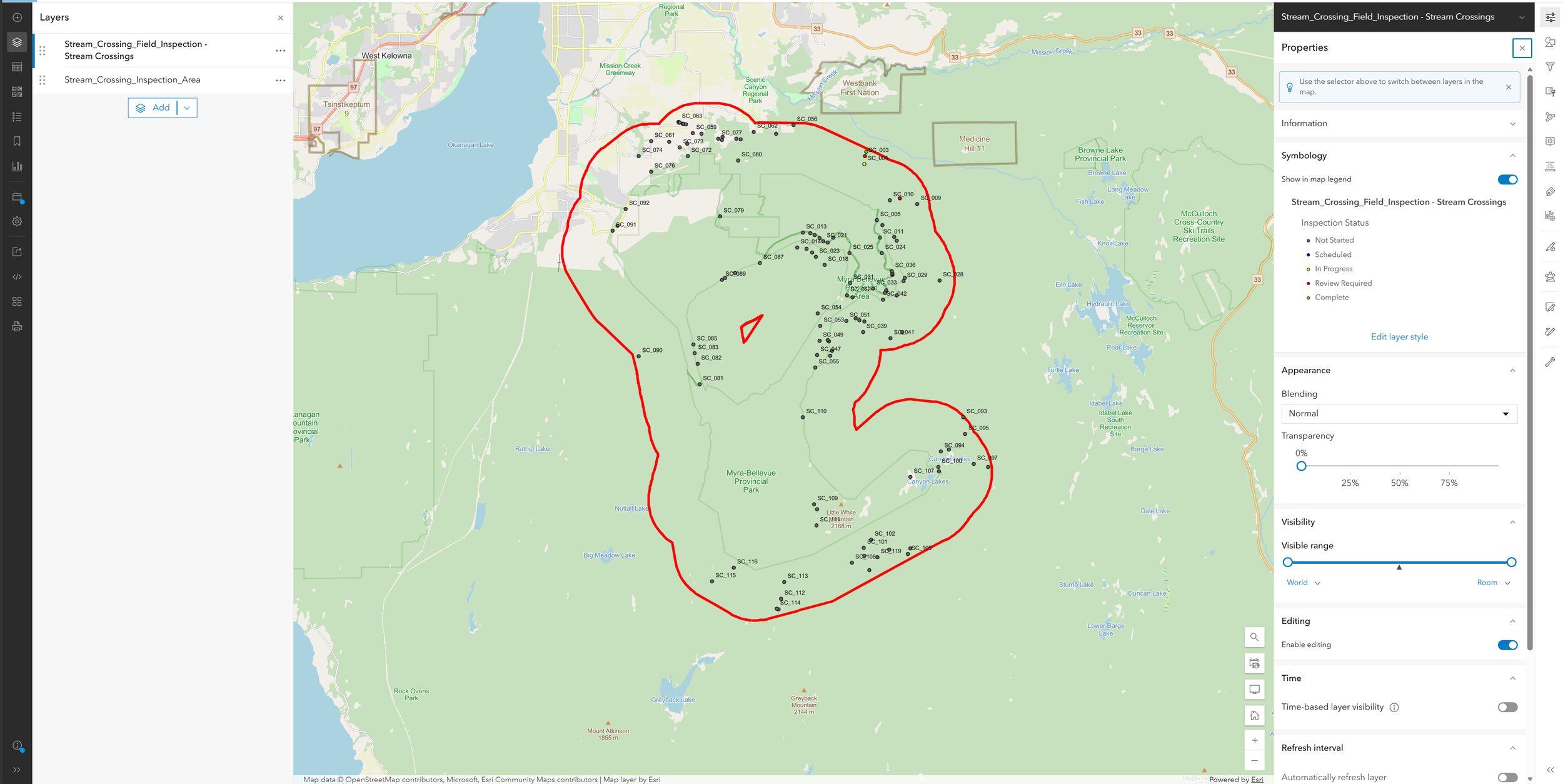
Road and stream datasets were processed in ArcGIS Pro to identify individual road–stream intersection points across the Myra-Bellevue study area. Multipoint records were reviewed and converted into 121 separate point locations, each with a unique crossing identifier.
The crossing inventory was enriched with supporting information such as:
Road name and road classification
Stream name and watershed identifier
Nearby wetland context
Protected-area context
Proximity to known fish-observation records
Field assignment and planned inspection date
Current inspection status and follow-up priority
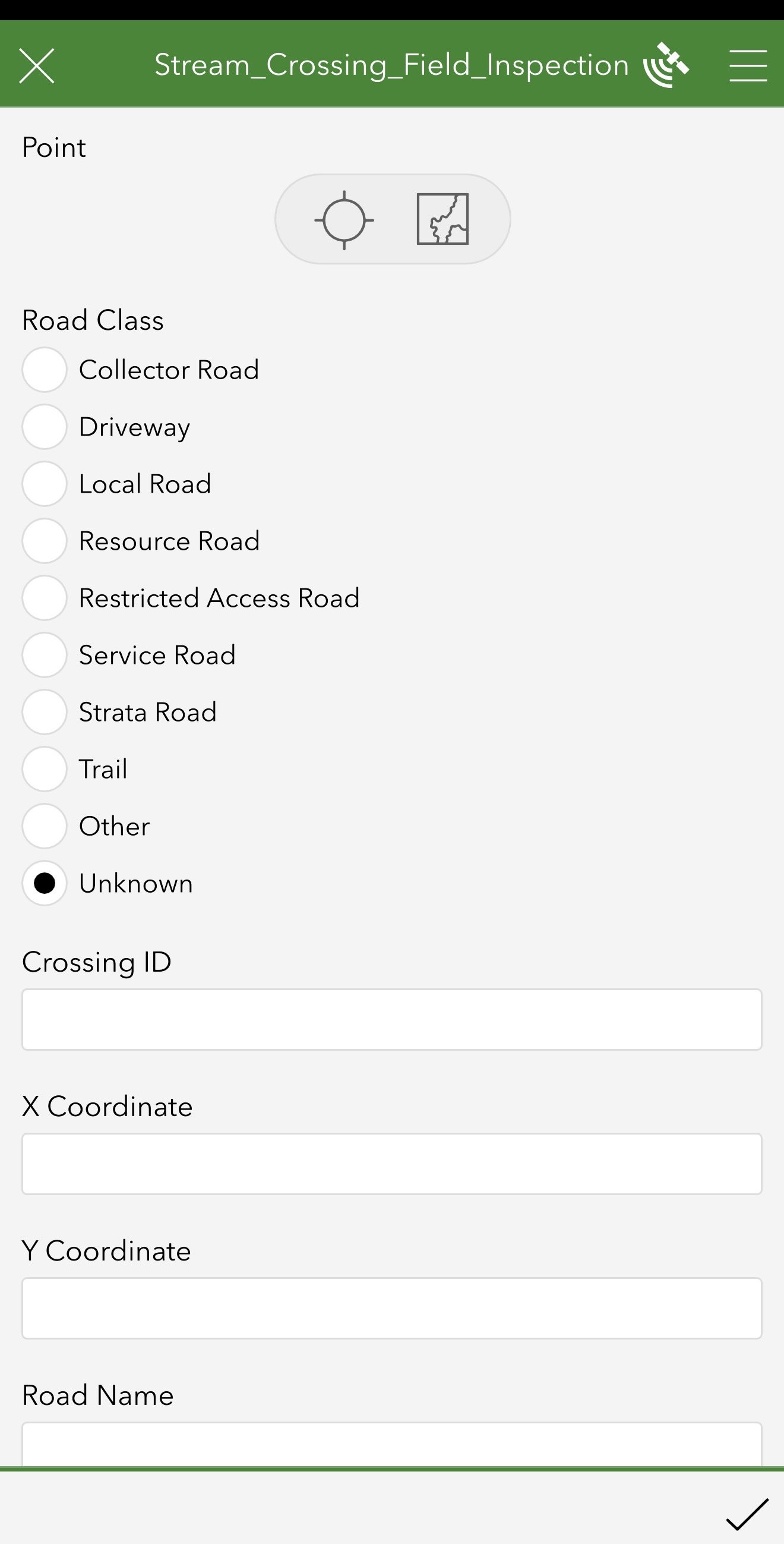
Domains were applied to fields such as road class, inspection status, priority, assignment, and environmental context. This creates controlled dropdown values, reduces inconsistent data entry, and supports clear status-based mapping.
-
The workflow uses a one-to-many relationship between the permanent Stream Crossings point layer and a related Crossing Inspections table.
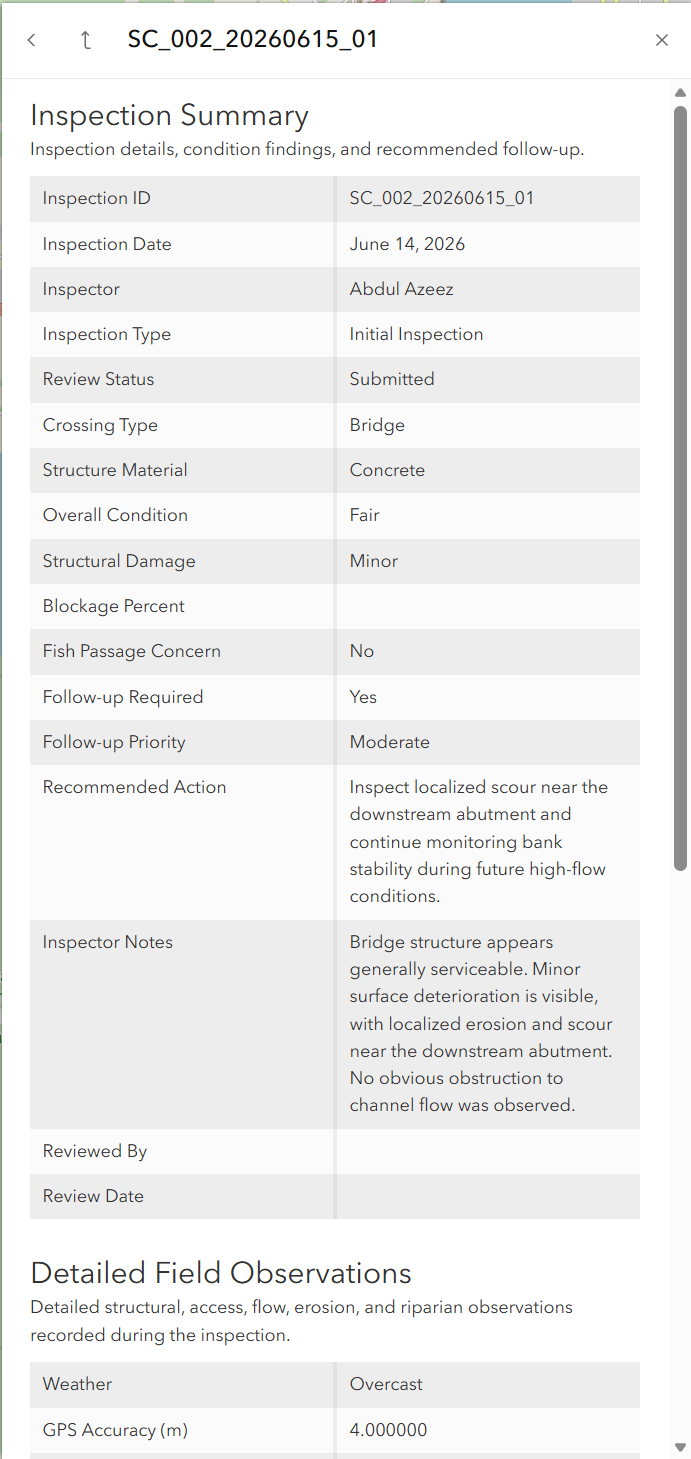
Each crossing stores stable location and environmental information. The related table stores visit-specific observations, including:
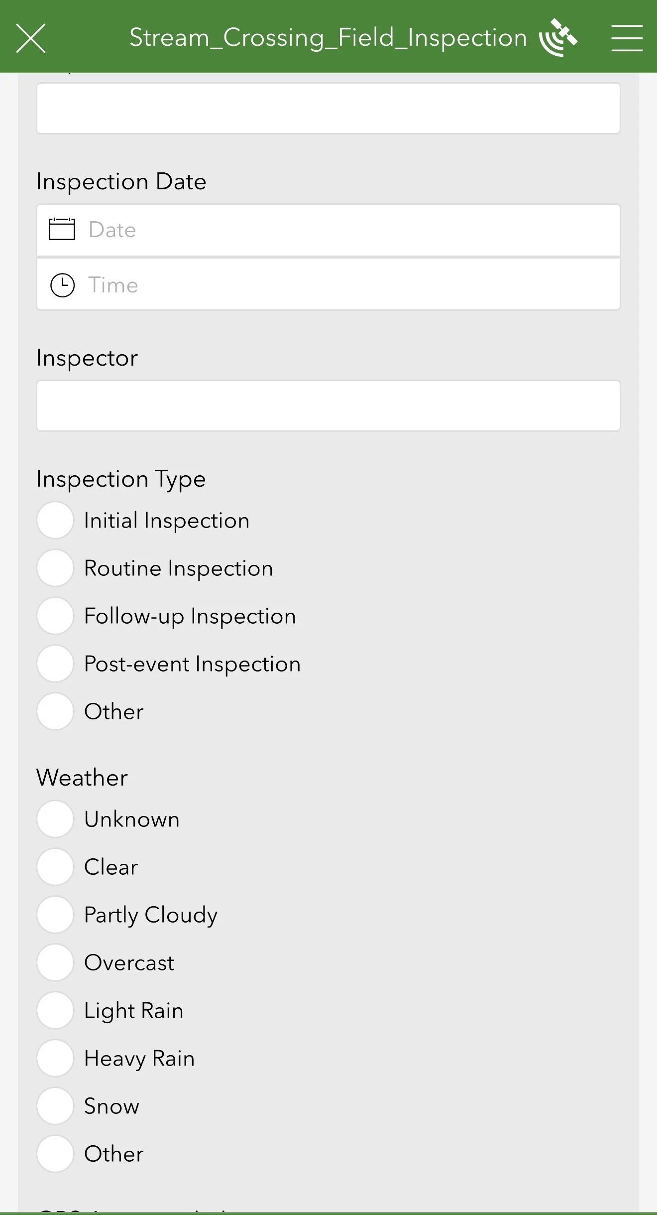
Inspection date, inspector, weather, and access condition
Crossing type and structure material
Inlet, outlet, blockage, and structural condition
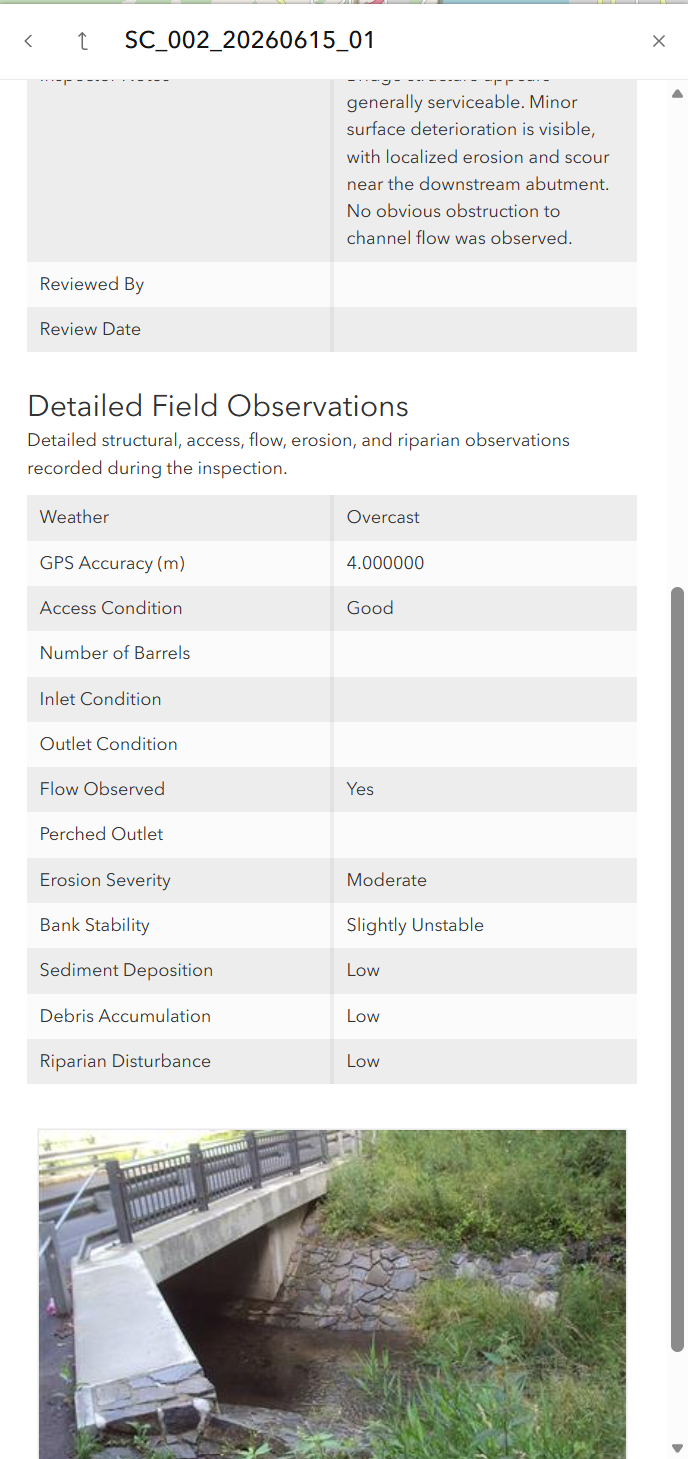
Flow, erosion, bank stability, sediment, debris, and riparian observations
Fish-passage concerns
Follow-up requirements, priority, recommendations, and review status
GlobalID and GUID fields maintain the relationship between the parent crossing and its inspections. This allows a single crossing to retain multiple inspection records over time without duplicating its location or background information.
Photographs are stored as attachments on the individual inspection record so each visit can maintain its own supporting imagery.
-
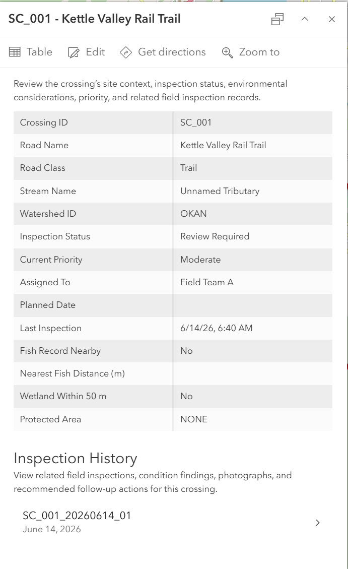
The crossing layer and related inspection table were published together as a hosted feature layer in ArcGIS Online. Pop-ups were configured to show crossing context, current status, environmental considerations, and related inspection history.
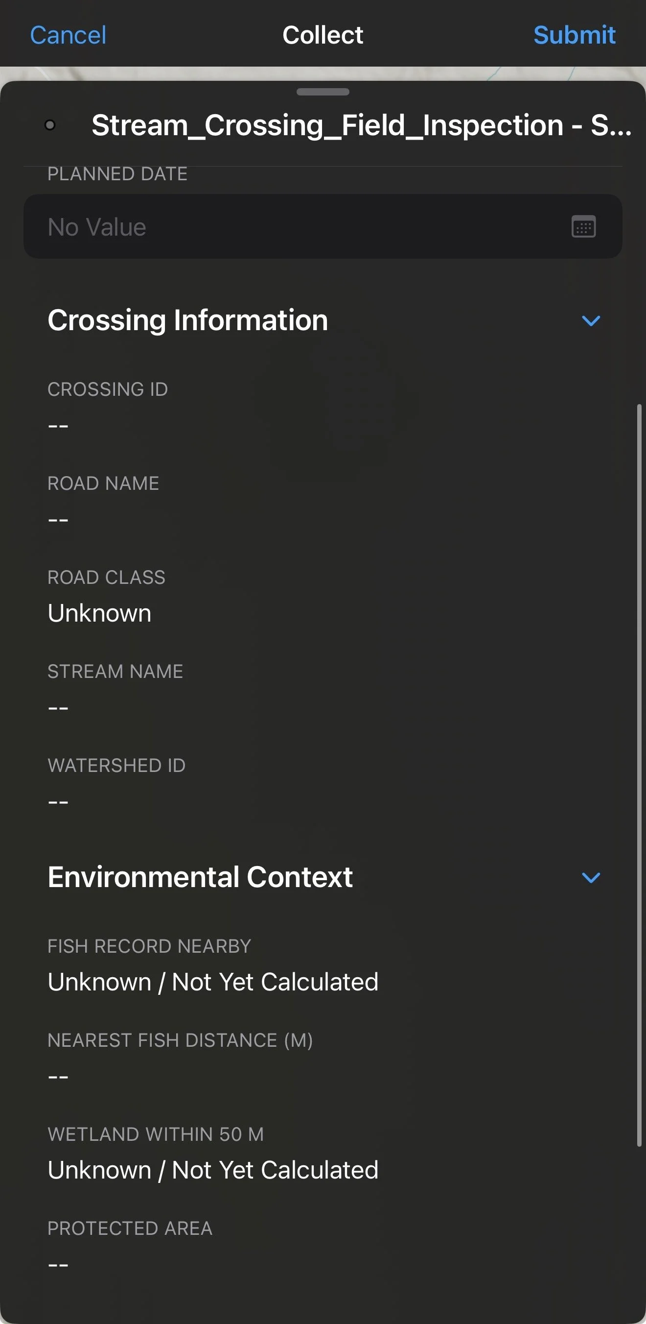
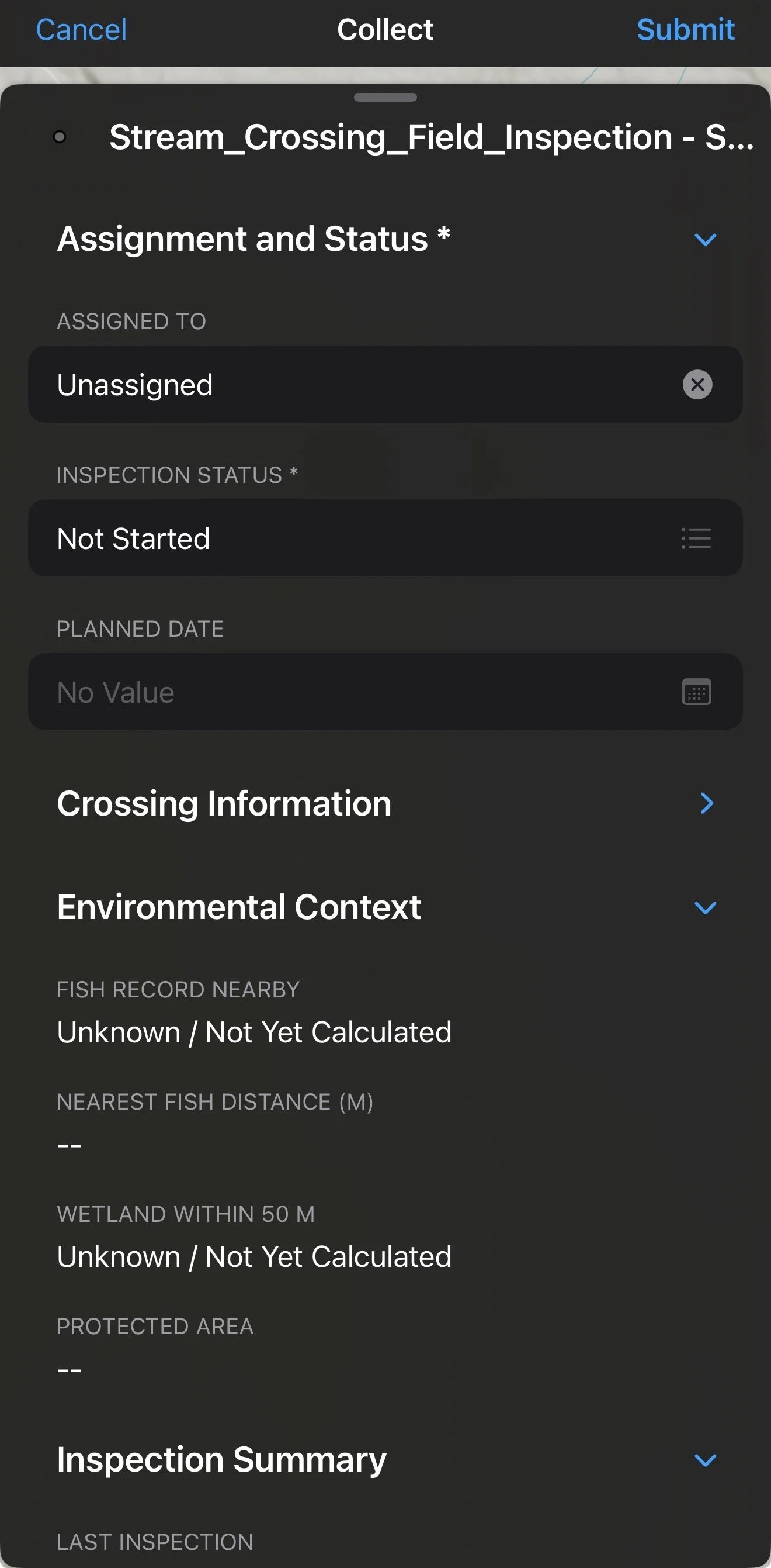
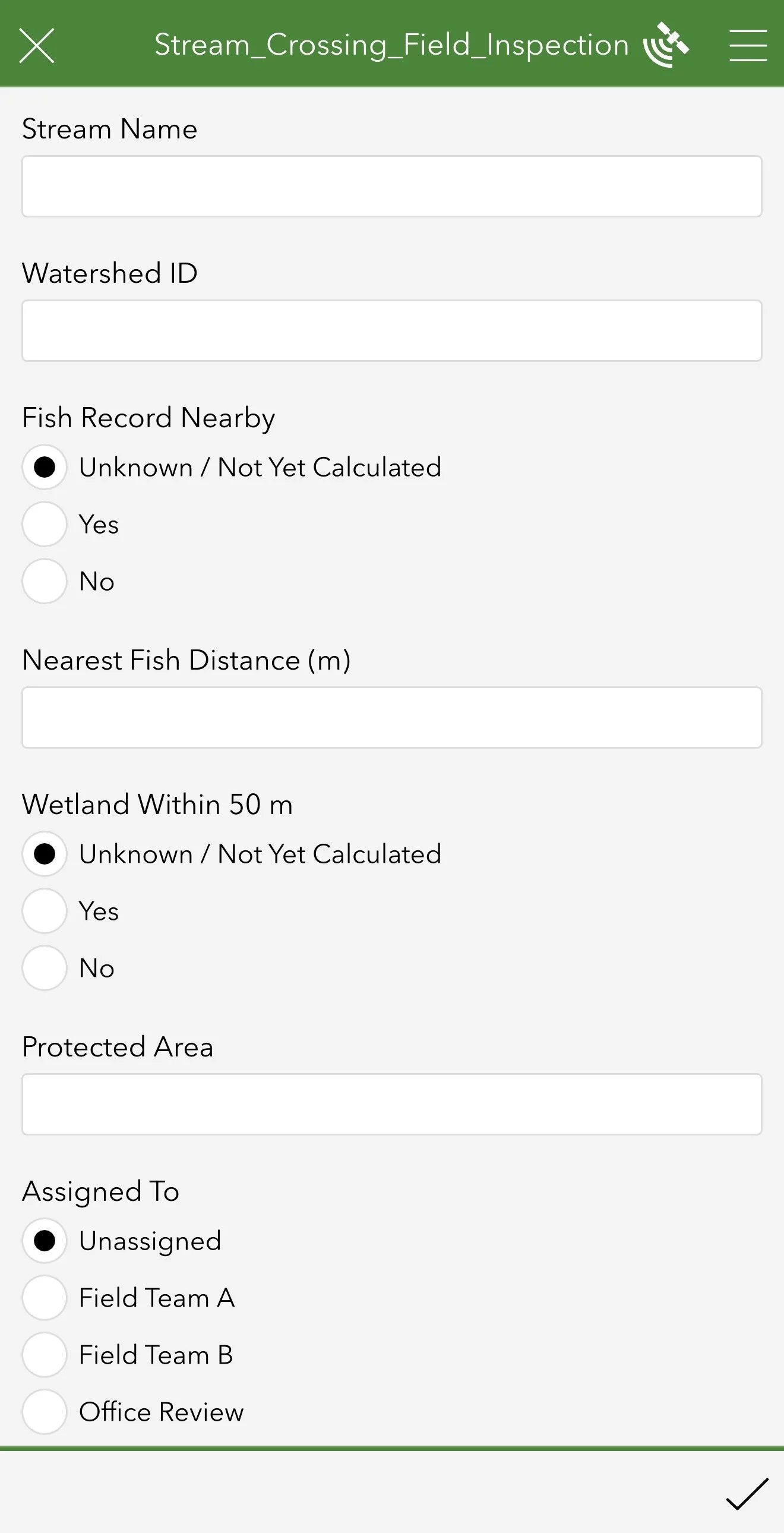
The Field Maps form separates information according to how it should be used:
Assignment, status, and planned date remain editable
Crossing, road, stream, and watershed information are read-only
Environmental context is read-only
Last inspection and current priority provide a concise inspection summary
A lightweight Survey123 form was also configured from the existing feature service to demonstrate structured inspection data collection. The form includes standardized inspection fields, conditional questions based on crossing type, follow-up information, and photo attachments. This provides an alternative interface for more detailed inspections while Field Maps remains focused on navigation, crossing context, assignment, and offline access.
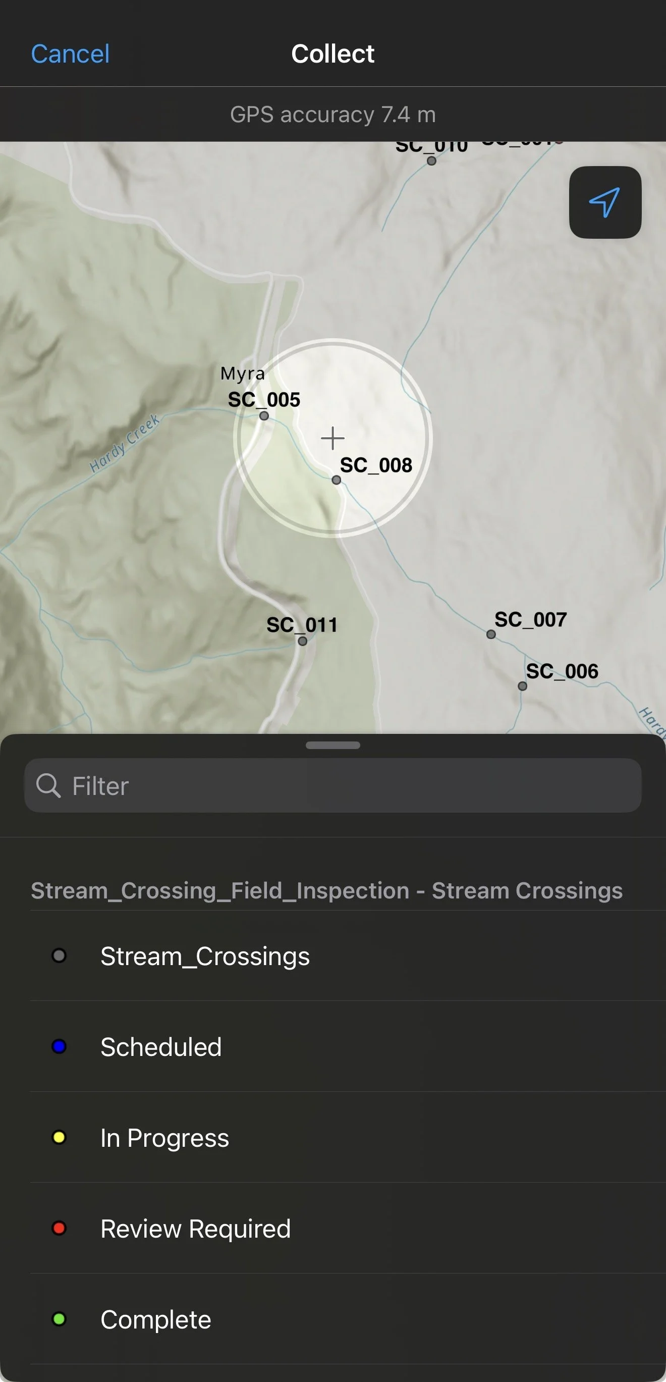
Crossings can be searched by their unique identifier, allowing a field worker to quickly locate records such as SC_001 or SC_074.
A predefined offline map area was created so crossing locations, related records, photographs, forms, and basemap information remain available without cellular service. Edits can be stored on the device and synchronized after connectivity is restored. description
-
The completed workflow provides:
A searchable inventory of 121 stream-crossing locations
Standardized road, stream, and environmental context
Structured repeat-inspection history
Related photographs and supporting documentation
Controlled data-entry fields and status values
Mobile forms designed for field use
Status- and priority-based visualization
Offline map access and synchronization
Centralized review and follow-up information
Structured Survey123 inspection form
Conditional inspection questions and photo attachments
The project demonstrates how mobile GIS can improve consistency between field collection and office review while maintaining a clear, traceable record of inspection activity.

This representative portfolio workflow was developed using public/open datasets, simulated stream-crossing inspection records, and representative imagery. It is intended to demonstrate GIS data management, related records, mobile field forms, attachments, and offline workflows, and is not an official assessment or operational product.